Digital Orienteering Map Archive for Gregory Blot
|
Zaloguj
Wszyscy użytkownicy
|
Język:
Polski
Česky
Dansk
Deutsch
Eesti
English
Español
Français
Italiano
Magyar
Norsk
Polski
Português
Русский
Svenska
Türkçe
Український
|
DOMA 3.0.10
Pokaż podgląd map
Ukryj podgląd map
|
KML
|
Powrót
<< O'Tramontane Etape 1 (13/07/2013)
|
O'Tramontane Etape 3 (15/07/2013) >>
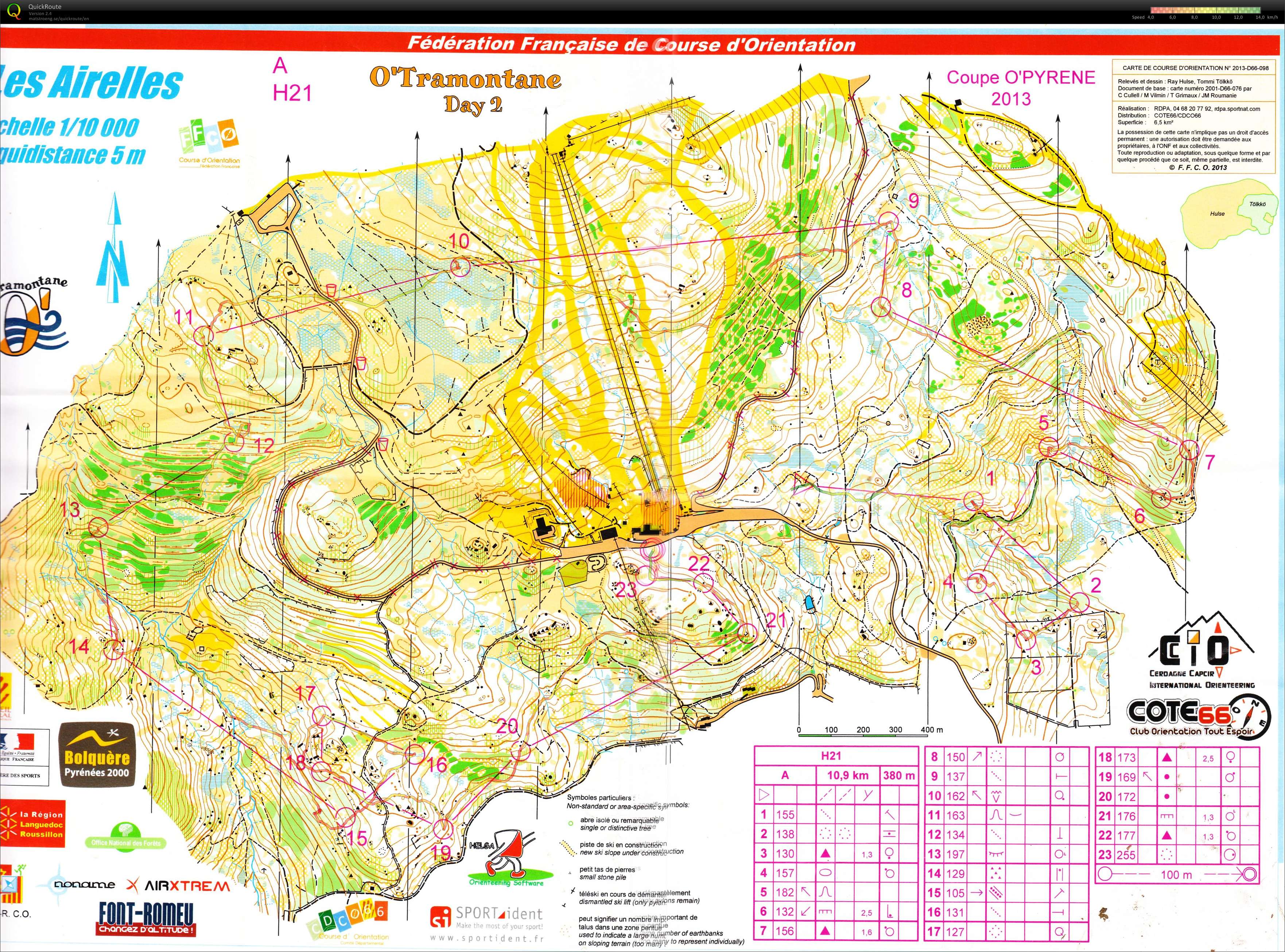
O'Tramontane Etape 2 (14/07/2013)
Kategoria:
Compétitions
Mapa/teren:
Les Airelles
Organizator:
CDCO 66
Kraj:
France
Konkurencja (dystans):
CO
Dystans:
12.99 km
Czas:
114:26
Średnie tętno:
159
Maksymalne tętno:
174
Une bien meilleure course que la précédente! Et pourtant, quelques erreurs d'approximation (1, 4, 12, 15). Mais le terrain était très difficile (visibilité, sol) et très physique. J'ai a priori fait les bons choix sur les longs postes.
Pokaż komentarze
Ukryj komentarze
(
0
)
Dodaj komentarz
Nazwa:
E-mail:
Zapisz
 Polski
 Česky
Česky Dansk
Dansk Deutsch
 Eesti
Eesti English
 Español
 Français
 Italiano
 Magyar
 Norsk
Norsk Português
 Русский
 Svenska
 Türkçe
 Український